
Louisiana Street Directory Search Steps
A Louisiana street search works best as a chain of records, not as one list of everyone in a home. The assessor ties a parcel to an owner and tax mailing address; a clerk's deed index traces recorded transfers; a municipal permit file may add a dated project or applicant. Voter information and older reverse directories can add context, but neither is a complete list of current occupants. Start with one known address, preserve the spelling shown on an official map, and move from one source to the next only when its record answers a different question.
- Standardize the street line with the USPS address lookup. Its result checks postal assignment, not who occupies the address.
- Use the Louisiana Assessors' Association directory to reach the assessor for the correct parish. Search the address, owner, or parcel number, following that office's own form.
- Open the local GIS map, select the parcel, and copy its parcel ID or legal description. If the viewer has no street-wide browse, check house numbers one at a time.
- Search the Parish Clerk's conveyance index for the current owner as buyer or grantee, then use the prior seller as the next name in the chain.
- For a dated city record, check the local permit index; for past households, use a library or archive's reverse directory and verify the name in its alphabetic section.
Louisiana has no single statewide owner parcel card. Parish assessors and clerks set portal coverage, image access, and copy procedures, so the parish is part of the search key. The steps can establish who owns a parcel and what was recorded there; they do not establish that an owner lived on the street at a given time.
Normalize a Louisiana Street Directory Address
Postal, municipal, parish, and parcel systems can describe the same place in different ways. USPS can return a ZIP for an address, list ZIPs associated with a city and state, or show cities served by a ZIP. The postal city name is a delivery label, not proof that the property lies inside that municipality or that a person lives there. A ZIP can cross city or parish lines, and one city can use several ZIPs.
When a familiar street line does not find a parcel, try the official city name, the accepted street suffix, and the address without an apartment or lot field if the map separates those fields. Keep the postal version beside the legal description rather than replacing one with the other. For old addresses, a street rename, annexation, subdivision change, or rural-route conversion can interrupt a modern lookup.
- Situs address
- The physical location of the parcel, used by assessors, maps, and many local searches.
- Mailing address
- Where an owner asks to receive tax or property correspondence; it may be somewhere else.
- Parcel ID
- A local number for a mapped tax parcel. Keep its hyphens and leading zeroes.
- Legal description
- A written land location such as lot, square, subdivision, section, or metes and bounds.
Note: Use the postal result to standardize the street line, then verify the parcel with the local assessor before treating the match as exact.
Louisiana Street Directory Parcel Details
The assessor is the starting point for present parcel ownership, not a statewide resident directory. Louisiana has 64 parish offices and no shared statewide parcel search. The Louisiana Assessors' Association directory routes to each office's website and phone number. New Orleans, Lafayette, and other parishes use their own systems, and one parish's search fields should not be assumed to exist in the next.
A property card may show the owner of record, mailing and physical addresses, parcel or tax-bill number, legal description, tax year, assessment values, sale data, and exemption flags. A homestead flag is tax evidence associated with an owner, not proof that the owner is the only person living there. Non-owner household members generally do not appear on an assessor card. New Orleans assessor instructions warn that a map or building sketch is not a legal survey and that assessment data can be incomplete or out of date.
When the web search is unclear, call the parish office to confirm its parcel number or official situs address. A counter visit can reach the parcel card or public terminal; a written request can identify the custodian, parish, address or legal description, record type, date range, and desired copy format under Louisiana's public-record inspection law. Fees and certified-copy rules depend on the office.
Note: A different tax mailing address can point to an estate, trust, company, or nonresident owner, but it does not identify the people inside the home.
Louisiana Street Directory GIS Layers
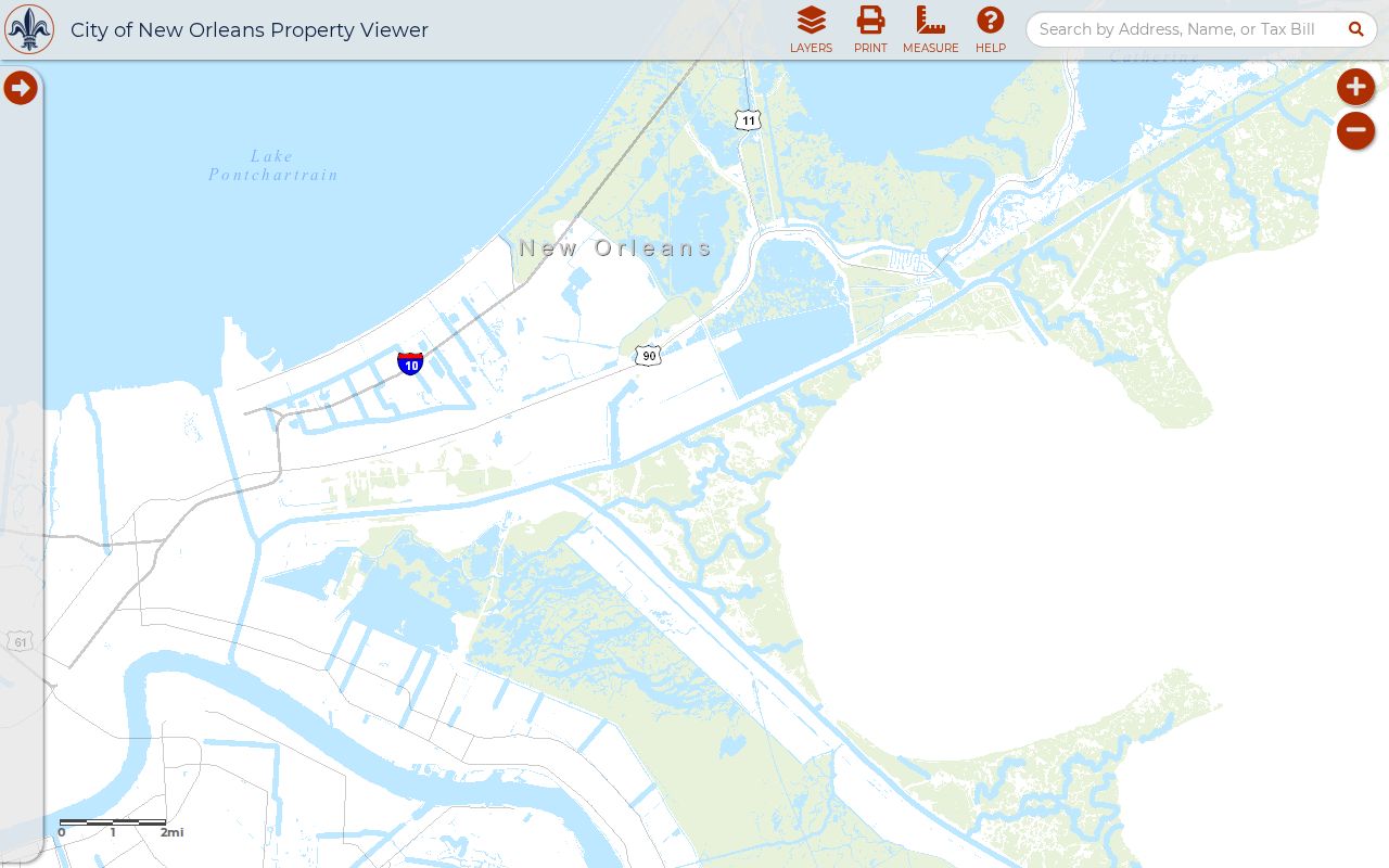
A local geographic information system, or GIS, places parcel lines on a map. The New Orleans Property Viewer is one documented municipal example: it displays parcels, zoning districts, future land use, and site-specific zoning actions, with links toward assessor records. These are New Orleans layers, not statewide fields. Other parish or city viewers may show flood zones, school or election districts, roads, drainage, historic districts, or only basic parcel outlines.
In a map that supports parcel selection, search the address or pan to it, click the parcel polygon, and copy the parcel number before leaving the map. Click nearby polygons to follow the street; a measuring, buffer, or select tool is available only where that local viewer supplies one. The statewide LADOTD boundary layer identifies parishes, but it is not an owner parcel map.
| Map control or layer | What to check | Louisiana scope |
|---|---|---|
| Address or parcel search | Find a street line or enter a copied parcel ID | Local viewer; formats vary |
| Selectable parcel | Parcel boundary, ID, and assessor link | Parish or municipal map |
| Zoning and land use | District, future use, or site-specific action | New Orleans example; other layers vary |
| Flood or district layers | Geographic context around a property | Only where the local map offers them |
| Pan, identify, or measure | Nearby parcel selection and map navigation | Tools differ by viewer |
The New Orleans viewer's map can help show how a parcel sits beside other lots, but zoning and land-use layers do not name household members.
The official New Orleans parcel and zoning map illustrates how a street search can move from a location to the surrounding property shapes.
Use the map as a geographic index, then confirm ownership and property details in the parish assessor's own record.
Louisiana Street Directory Records by Address
Several Louisiana records can be reached from an address, but each describes a different event or relationship. The assessor gives the current parcel and tax account; a deed index records transactions; a permit system logs municipal work or enforcement; the voter portal provides limited election information. Use the source that fits the question, and treat historical directories and maps as dated evidence rather than a current household count.
| Record Set | Keeper | What It Shows | Access |
|---|---|---|---|
| Assessor parcel | Parish assessor | Owner, mailing and situs addresses, value, exemptions, legal description | Local web search, office, or public-record request |
| GIS parcel map | Parish or municipal GIS | Parcel shape, ID, nearby lots, and offered map layers | Local viewer; layers vary |
| Conveyance and mortgage | Parish Clerk of Court | Recorded parties, instrument date, legal description, liens, or mortgage | Local clerk portal, counter, or copy request |
| Permit or code case | City or parish office | Work record, applicant or license holder, status, and date | Municipal system; New Orleans One Stop begins in 2007 |
| Voter address search | Secretary of State or registrar | Election information available under privacy rules | Voter Portal or local registrar |
| Reverse directory | Library or archive | Dated address-to-household or business entry | Local collection; access varies |
| Plat or Sanborn map | Clerk, assessor, archive, or Library of Congress | Lot, block, building footprint, street, or development context | Digital map where available, library, or plat room |
Carry the parcel ID and legal description from one record into the next. A street name can help align the assessor, permit, and voter address, but those databases do not share a common statewide household key. If an online index ends at a date cutoff or returns no image, the clerk's counter, a phone call, and a written request remain useful; older maps and books may be at the parish or state library.
Louisiana Deeds by Street
The Parish Clerk of Court is the conveyance and mortgage custodian. Statewide eClerks LA links and participating parish portals lead to local services, but parish coverage, image access, and subscription rules differ. A deed chain starts with the assessor's current owner and parcel description. Search that owner as the buyer or vendee, note the seller or vendor and instrument, then search backward under that seller's name. Recheck the lot, square, subdivision, or section at each step.
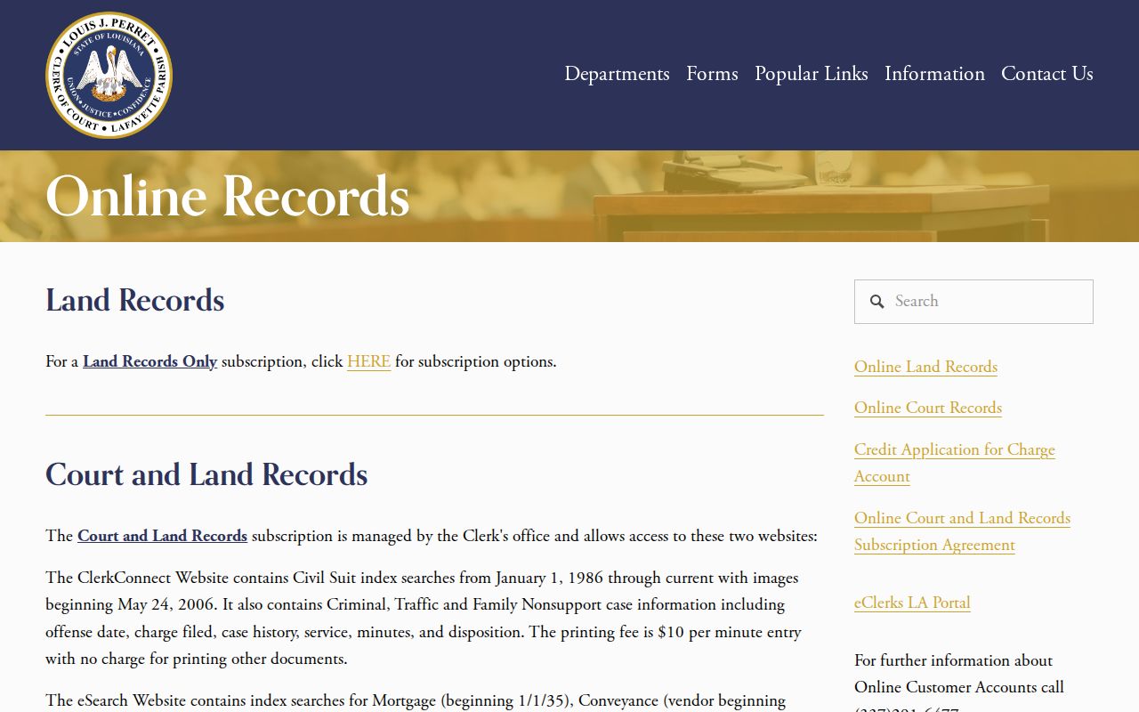
Lafayette's published online land-record page provides a specific example, not a statewide cutoff: its conveyance vendor index begins in 1935, its vendee index in 1966, and conveyance images begin in 1935. The page lists a $100 setup charge and $65 per month per user for subscription access; image and print costs are separate.
The Lafayette Parish Clerk's land-record page documents which online index reaches which years and what a subscriber can access.
For records beyond a portal's cutoff, contact the clerk about public terminals, deed books, certified copies, and archived indexes. The clerk remains custodian even when a microfilm copy is held elsewhere.
Lafayette's vendor and vendee indexes start in different years, so try both name roles before treating a missing online result as a gap in the chain.
Louisiana Permit Records by Address
Permits and code cases can supply dates for work or a municipal action at a street address, but they do not prove who lived there. New Orleans One Stop covers permits, licenses, planning projects, and code-enforcement records from 2007 to the present. A basic public search can start with a street address; the system recommends entering the street line without city, state, ZIP, or apartment first. Results can include a record summary, date, status, applicant or license holder, and linked documents.
The One Stop help page explains its address and advanced search fields. A free account adds filters such as record type, Council District, application dates, and description terms. If an address does not resolve, the city says it may not be the legally recognized address, a subdivision update may be pending, or the record may contain an error; call 504-658-7100. Other Louisiana cities and parishes use their own systems and date ranges.
Note: A permit names an applicant or license holder for a city record; it does not show that person lived at the work site.
Louisiana Voter Records by Address
The Secretary of State's Voter Portal address search accepts a ZIP and street address, with optional apartment or lot and city fields. It can help check election information associated with a known address. The portal's design does not publicly link all registrants to addresses, and its disclaimer keeps Social Security number, email, full date of birth, mother's maiden name, assistance entitlement, and protected records private. A missing result therefore does not settle whether a person lives nearby or has a record.
The full voter-list channel is separate from the public screen. The Secretary of State offers voter-list products under election-law restrictions; those may include home and mailing addresses, age, race, party, and district fields, while email is protected. Contact Elections Services or the local Registrar of Voters for permitted formats and limits. Do not scrape the portal or republish a street roster. Louisiana's address-confidentiality participants can use a substitute address and may not appear as a normal physical-address match.
Note: Voter information can support a limited civic check, but it should not be treated as a complete resident list for a Louisiana street.
Louisiana Street Directory History
Reverse or criss-cross directories arrange entries by street address and can place a dated household or business on a block. New Orleans has an unusually deep local run. City Archives records show street cross-reference beginning in 1932, R.L. Polk suburban volumes starting in 1955, and Haines CrissCross volumes from 1966. The volumes before a cross-reference year may need an alphabetic directory or business listing to bridge a name to the street. These dates describe New Orleans collections, not every Louisiana town.
The New Orleans City Archives directory collection describes its print, microfilm, and digital access routes and offers appointment and search-copy options. The State Library's Louisiana Collection and parish libraries are other places to ask about local directories, phone books, maps, and microfilm. For statewide background on collections, see the Louisiana city directory collections page.
For an older block, pair an address with the owner name, legal description, plat, and historic map. The New Orleans street cross-reference gap before 1932 cannot be solved by entering an old address into a modern search box; use the alphabetic entry and land record as separate links in the trail. The Louisiana State Archives notes that some parish records require permission from the parish clerk.
Note: Louisiana parish archives hold uneven runs, so ask the local clerk and library about a specific record series before traveling.
Louisiana ZIP and Street Boundaries
A street can fall inside one parish for land records, another municipal service area for permits, and a USPS city label used for delivery. ZIP codes also cross parish or city lines, while one municipality can have several ZIPs. Use USPS to verify the current postal line and a parish assessor or local GIS to verify the parcel. Louisiana has 64 parishes, so an apparently nearby address may lead to a different clerk, assessor, or permit office.
When a street search fails, compare the mailing address with the legal description, lot and block, subdivision plat, historic map, and assessor parcel history. A renamed road, annexation, new subdivision, or rural-route conversion can explain why the current street number does not match an older deed or directory. There is no single statewide street-renumbering year; use the local address authority when a number change affects a property record.
A ZIP result confirms the postal assignment, not the identity of a person or business at that address. Verify ownership with the parish assessor and use the record type that answers the actual question.
Louisiana Street Directory Privacy Limits
A Louisiana street directory search cannot identify every person who uses a home. The assessor lists property owners, not a household census; deeds name parties to recorded instruments; permit files name applicants or license holders. Non-owner household members, relatives, guests, and other occupants usually do not appear in those records. A mailing address may be a fiduciary, company, or out-of-parish contact rather than an occupant's home.
Driver address records are restricted by the federal Driver's Privacy Protection Act, and utility-customer and private delivery details are not public government rolls. The Louisiana Address Confidentiality Program gives eligible participants a substitute address for state and local services; a protected resident's physical location is not public. Some public employees and judges have additional address or contact protections. Do not try to infer a protected location from another household member or from map layers.
Lawful use. Public records can support personal research, family history, or a property question. Louisiana law prohibits stalking and harassing communications; public access is not permission to threaten, follow, or intimidate another person.
For a confidentiality question, use the Louisiana Address Confidentiality Program and its official guidance. Respect limits on protected records, and stop if a custodian says a record is restricted.